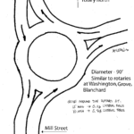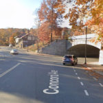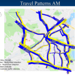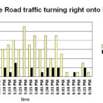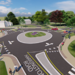
I hope to recruit a high school student to work with me on a Belmont traffic project for community service. The project will use the rotary at the intersection of Grove, Blanchard and Washington Streets to estimate the effectiveness of similar rotaries at the entrance to McLean Hospital at Mill Street, and at the intersection of Concord Avenue and Common Street at Belmont Center. I am a retired electrical engineer with an advanced degree from MIT. I did a traffic study in 2017 with a high school student to estimate Belmont’s cut-through traffic during the morning rush hour. Here are [READ MORE]
Letter to the Editor: Traffic at McLean
To the Editor; On June 26, Belmont Town Meeting approved the amended Traffic Monitoring and Mitigation Agreement between Belmont and McLean Hospital. Part of the agreement is to improve the intersection of McLean Drive and Mill Street. The plan is to install adaptive traffic signals at the intersection that use a camera and software to control the lights based on what is needed on a moment-by-moment basis. In 2017, a high school student who needed community service credits and I spent the summer counting cars to estimate the cut-through traffic in Belmont during the morning rush. We did good work. [READ MORE]
Town Works to Make Streets Safer for All
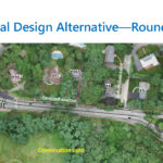
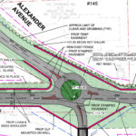
By Sue Bass If you’ve noticed more speed bumps on Belmont’s streets, it’s not your imagination. They are a small clue to a new direction the town hopes to take: to slow traffic and make our roads safer for pedestrians and bicyclists. Two major projects are on the horizon, if construction money can be found: signalization and pedestrian amenities at Huron Avenue and Grove Street, and two roundabouts at Concord Avenue and Mill and Winter Streets. The Winter Street roundabout will need some political magic in addition to money. Meanwhile, two quicker projects are about to get underway. A $432,000 [READ MORE]
Concord Bike Lane May be Increasing Cycling
By Dan Eldridge This August will mark two years since the restriping of Concord Avenue, a project that repainted the lines on the road to switch the positions of the biking and parking lanes. Separated (sometimes called protected) bike lanes are against the curb and are usually separated from traffic by bollards, islands, or raised platforms: there are no plans to install bollards on Concord Avenue. In each case, a barrier is created so cyclists will encounter fewer vehicles and feel more secure. In the case of Concord Avenue, separation is indicated by painted lines and parked cars only. Separated [READ MORE]
Vision for a Better Belmont: Chris Ryan
This is the fourth of a new series of interviews with Belmont leaders about their vision for Belmont’s future. Jeffrey North conducted this interview. It has been edited for length and clarity. – Ed. Chris Ryan has served as Belmont’s town planner and director of planning and building (OPB) since September 2023. With more than 30 years of experience in city planning and economic development, Chris has worked at the town, city, county, regional, and state levels in the public sector in at least 10 communities and the New Jersey Meadowlands Commission; the Metropolitan Area Planning Council; and the Central [READ MORE]
Letter to the Editor: Bike Safety
My home is in Waltham, and my dentist’s office is in Arlington. I have occasion to ride my bicycle through Belmont on the way there and back. Today (May 22, 2023) I was waiting for the red light at Cross and Brighton Streets when a car approaching in the opposite direction got a green light, but the light remained red for me. I had to run the red light to get through the intersection and I had no way to know when the red light for the cross traffic would turn green. The same thing happened a second time on [READ MORE]
Belmont School Traffic Needs Attention
By Larry Link The figures still catch my breath. A 2018–2019 pre-HS/MS construction study documented nearly 2,000 cars traveling down Concord Avenue from the snarl at the underpass (by most experienced hands, “unsolvable”) in Belmont Center to the High School-Middle School site opposite Goden Street, in just the morning 7 to 9 AM rush. Of all vehicles clocked in that special Registry of Motor Vehicles (RMV) study using automated license plate reader information, 75% entered and left Belmont within 15 to 20 minutes but were registered/garaged in other towns! While we don’t have a new count yet, many Goden Street [READ MORE]
Letter to the Editor: Belmont Cycling Safety
To the Editor: I am a long-time Boston-area bicycling advocate, CyclingSavvy Instructor, and League Cycling Instructor, responding to the article by Jeff Roth in the July-August Belmont Citizens Forum Newsletter. I am pleased to see progress on the Belmont Community Path and the Alexander Avenue underpass; also proposals for traffic calming and roundabouts. However, the article states: “Protected bicycle lanes (PBLs) lower crash rates by a factor of two to 23 times . . . ‘Dooring’ crashes, which account for 20% of bike/car crashes, disappear almost completely with PBLs.” The term “protected bike lanes” wraps itself in its own conclusion. [READ MORE]
Bike Infrastructure Makes Belmont Safer
By Jeff Roth Few Belmont residents use bikes to get around this small town of only 4.7 square miles, although most live hardly a mile from schools, recreation facilities, stores, transit stations, and restaurants. About 8.2% of Cambridge residents commute regularly by bike, but Belmont’s car-centered infrastructure likely is closer to the state average of 0.9%. Given that short, local trips are responsible for 60% of automobile pollution, how can we encourage car-free travel? Benefits of Walking and Cycling There are many benefits to expanding cycling and walking options in Belmont. People who cycle regularly for transportation and fitness have [READ MORE]
2021 Select Board Candidate Answers BCF Questions
Each year, the Belmont Citizens Forum asks Select Board candidates questions about issues facing our town. This year, Mark Paolillo, who is running unopposed, provided answers. He was limited to 1,200 words. Describe your vision for preserving and enhancing Belmont’s quality of living, learning, working, and connecting. Preserving and enhancing Belmont’s quality of life must begin with making town finances stable and sustainable. This will require a more in-depth approach to long-term structural reform. Belmont should consider the use of performance management budgeting which measures resource input against the resulting output of services for each department. That will help us [READ MORE]
Belmont Traffic Committee Chair Tells All
By Sumner Brown Dana Miller chairs Belmont’s Transportation Advisory Committee. She has been a member of the Traffic Advisory Committee, the predecessor to the Transportation Advisory Committe (TAC), since 2009. I talked with Miller in November 2020. This interview has been edited for length and clarity. BCF The name of your committee changed from Traffic Advisory Committee to Transportation Advisory Committee. Why? Miller The Select Board changed the committee name in 2019 to make clear that the committee’s responsibilities encompass safety for pedestrians and those on bicycles, as well as those traveling in vehicles. BCF Who are the members of [READ MORE]
Building Booms on Belmont’s Border
By Meg Muckenhoupt Since aggressively upzoning the Alewife area a decade ago, Cambridge has permitted hundreds of thousands of square feet of new development in the Quadrangle neighborhood adjacent to Belmont, and bordered by Fresh Pond Parkway, Fitchburg line railroad tracks—and Concord Avenue. Now, even more development could solve some long-standing transportation issues, or it could make getting out of Belmont or traveling around the entire Fresh Pond area even more difficult. Why build in the Quadrangle now? Unlike the rest of Cambridge, the Quadrangle has a history of sparse development. Originally one of the lowest-lying areas of the Mystic [READ MORE]
Community Path Proponents Offer FAQ
By Sara Smith, Eric Batcho, and Jarrod Goentzel What is the Belmont Community Path? The Belmont Community Path is a proposed shared-use path running just over two miles through Belmont along the former Central Massachusetts Railroad line connecting Cambridge and Waltham. It is a critical link in the 104-mile Massachusetts Central Rail Trail (MCRT) between North Station and Northampton. See a map and more details on the MCRT at www.masscentralrailtrail.org/interactive-google-map. Who is it for? The shared-use path is for a wide variety of non-motorized users, including walkers, runners, bicyclists, roller skaters/bladers, wheelchair users, and people walking dogs on leashes or [READ MORE]
25% Belmont Bike Path Design Presented
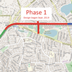
By Jarrod Goentzel Recent meetings offered a first look at the official 25% draft plan for the Belmont Community Path, which should include most significant features, and continued conversations with state leaders about how and when it can be built. On July 16, the Community Path Project Committee (CPPC) held a virtual public meeting for the design firm, where Nitsch Engineering presented draft 25% design drawings for the first two construction phases (bit.ly/20200716BCPpresentation). A video of the full meeting, including public questions and feedback, is available at Belmont Media Center (bit.ly/20200716BCPvideo). Phase 1 includes the rail trail from Brighton Street [READ MORE]
New Rock Meadow Parking Plan Proposed
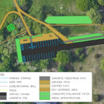
By Jeffrey North and Mary Trudeau The Belmont Conservation Commission recently engaged a team of Northeastern University students to explore parking lot and stormwater drainage improvements for Rock Meadow. As visitors to Rock Meadow can attest, the parking lot is inefficient, rutted, partially paved, and often filled with pockets of standing water. Improvements have been called for since at least 1968, when the report, A Program for Renewing Rock Meadow, stated the obvious: “The entrance is not attractive and does not do justice to the beautiful area beyond.” The arrival experience is incongruent with Rock Meadow’s value as a treasured [READ MORE]
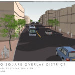
By Meg Muckenhoupt and Virginia Jordan The Bradford development in Cushing Square disrupted Belmont’s streets, sidewalks, planning, and politics, and stressed local businesses over the last decade. Town Meeting adopted a new overlay district in 2006 to channel development and provide the Planning Board with tools to control the scale and look of Cushing Village, now the Bradford, a three-building project comprising 38,000 square feet of ground-floor retail space, 112 residential units on upper floors, and 201 parking spaces. In the past 14 years, the town has learned some lessons about managing large construction projects—and how large construction projects affect [READ MORE]
Belmont Timeline
Belmont Timeline Featuring events significant to the Belmont’s history and Belmont Citizens Forum issues. 1654 The John Chenery house, 52 Washington Street, is built. The Chenery house is the oldest surviving house in Belmont. 1760 The Thomas Clark House is built on what is now Common Street. “Local tradition maintains that the Clark family witnessed the beginning of America’s War for Independence from the hill behind this house, seeing smoke and hearing the sounds of war breaking out on April 19, 1775.” —Joseph Cornish, BCF Newsletter, January 2011. It was moved in 2012, and finally demolished in 2014. 1805 “Ice [READ MORE]
20 Years of Belmont Traffic
By Sumner Brown Belmont has turned a corner about how we think of traffic. Twenty years ago, our hope was to find ways to make it easier for cars and trucks to pass through Belmont. Now our objective is to protect residential streets from rush-hour traffic and make life easier for pedestrians and bicyclists. The Belmont Citizens Forum has played a part in our traffic turnaround. In 2002, the Belmont Citizens Forum’s Planning and Zoning Committee brainstormed about Trapelo Road. They thought about bike lanes and lots of trees. The committee engaged graduate student classes at MIT and the Boston [READ MORE]
The BCF’s Origin
By Sue Bass This is the 20th anniversary of the Belmont Citizens Forum Newsletter; the organization was founded a little over 20 years ago. How did that happen, and why? In 1995, McLean Hospital began exploring publicly how to turn part of its 238-acre campus into cash. Psychiatric drugs had revolutionized mental health care; instead of long walks and fresh country air, medicine could prescribe quicker-acting treatment. McLean no longer needed a bucolic campus, and families relying on health insurance could no longer pay for it. The hospital was $40 million or more in debt. This was not the first [READ MORE]
May/June 2019 Belmont Citizens Forum Newsletter & PDF
View or download the May/June 2019 issue as a color PDF here, or read single articles below. Articles in this issue: New Plans for McLean Land Density is key issue as town considers proposals for two McLean campus parcels By Sue Bass Twenty years ago, Belmont voted to allow development on McLean Hospital land on Belmont Hill. Now McLean is coming back to the town with new proposals for two parcels of land that are still undeveloped. Read more. Composting in Belmont: Breaking it Down By Mary Bradley Composting is no longer just a backyard hobby for the ardent gardener. [READ MORE]