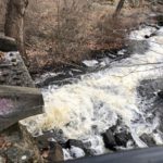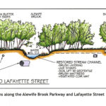
By Kristin Anderson and David White We are at an important point in the history of the Alewife Brook. The Massachusetts Water Resources Authority (MWRA) and the cities of Cambridge and Somerville are preparing a new long-term sewage control plan for the Alewife Brook/Upper Mystic River Watershed. Climate change, with its wetter rainy season, more intense storms, and sea level rise, is expected to result in more hazardous Alewife Brook sewage pollution and more flooding in the area. During some storms, the Alewife Brook floods into the houses, parks, and yards of area residents in environmental justice communities. Because of [READ MORE]
Belmont’s Watersheds Cross Many Boundaries
By Anne-Marie Lambert Here in Belmont, we live on the edge of two large watersheds—the Mystic River watershed and the Charles River watershed. Understanding our role in these watersheds is more important than ever as storms in the Northeast grow more intense and more frequent, and as the rise in Atlantic Ocean sea levels starts to affect the underground water table. The lack of alignment between our political maps and the topography of our watersheds can make it tricky to understand Belmont’s role. In the flat low-lying areas of town where there isn’t much gradient, waters flow in directions that [READ MORE]
Building Booms on Belmont’s Border
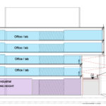
By Meg Muckenhoupt Since aggressively upzoning the Alewife area a decade ago, Cambridge has permitted hundreds of thousands of square feet of new development in the Quadrangle neighborhood adjacent to Belmont, and bordered by Fresh Pond Parkway, Fitchburg line railroad tracks—and Concord Avenue. Now, even more development could solve some long-standing transportation issues, or it could make getting out of Belmont or traveling around the entire Fresh Pond area even more difficult. Why build in the Quadrangle now? Unlike the rest of Cambridge, the Quadrangle has a history of sparse development. Originally one of the lowest-lying areas of the Mystic [READ MORE]