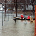
by Elissa Ely Shortly after the pandemic began, when the only response within anyone’s control was isolation, Julia Blatt and her husband bought kayaks. They had canoed as a family for more than 30 years—Montana, Idaho, Maine, Colorado, Florida, Vermont, New Hampshire—and for years her professional work had taken her kayaking through the Concord, Sudbury, and Assabet rivers. Sometimes she brought politicians with her (a form of visual education) and sometimes it was a form of solo field research. But this was different. The sky doesn’t know a pandemic is raging; birds and turtles have no idea and less interest. [READ MORE]
EPA Pushes for Alewife Sewage Cleanup
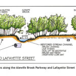
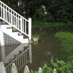
By Kristin Anderson and David White We are at an important point in the history of the Alewife Brook. The Massachusetts Water Resources Authority (MWRA) and the cities of Cambridge and Somerville are preparing a new long-term sewage control plan for the Alewife Brook/Upper Mystic River Watershed. Climate change, with its wetter rainy season, more intense storms, and sea level rise, is expected to result in more hazardous Alewife Brook sewage pollution and more flooding in the area. During some storms, the Alewife Brook floods into the houses, parks, and yards of area residents in environmental justice communities. Because of [READ MORE]
Belmont’s Watersheds Cross Many Boundaries
By Anne-Marie Lambert Here in Belmont, we live on the edge of two large watersheds—the Mystic River watershed and the Charles River watershed. Understanding our role in these watersheds is more important than ever as storms in the Northeast grow more intense and more frequent, and as the rise in Atlantic Ocean sea levels starts to affect the underground water table. The lack of alignment between our political maps and the topography of our watersheds can make it tricky to understand Belmont’s role. In the flat low-lying areas of town where there isn’t much gradient, waters flow in directions that [READ MORE]
Mystic Collaborative Plans For Climate Change
By Julie Wormser Once upon a time, images of climate change featured skinny polar bears on melting ice floes, and hot, dusty desertscapes. Tragic for sure, but also very far away in time and space. Not any more. Last summer’s alarming weather—from 120 temperatures in the Pacific Northwest to record flooding rains here in the Northeast—has brought the immediate effects of climate change into sharper focus and more local concern. In Greater Boston, the most likely risks we need to prepare for are: flooding from intense rainfall and coastal storms/sea level rise, hotter, drier summers, less predictable winter weather, and [READ MORE]
Watershed Modeling Enhances Flood Resilience
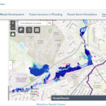
By Julia Hopkins and Julie Wood Climate change isn’t coming—it’s here. Sea-level rise, drought, blistering heat; the tangible effects of global warming are already happening in Massachusetts, and our highly urbanized watershed and those who call it home are increasingly vulnerable to its impacts. It also means extreme weather and severe inland flooding are some of the greatest threats to our watershed and our lives. In the northeastern United States, precipitation during heavy rain events increased by more than 70% according to the Fourth National Climate Assessment released in 2018. This trend is expected to continue as our climate warms. Today’s [READ MORE]
Fifty Million Gallons of Sewage Released
Discharges to Alewife Brook Have Persisted for Two Decades By Kristin Anderson and David White Fifty million gallons of sewage-contaminated stormwater have been discharged into the Alewife Brook from the cities of Cambridge and Somerville in 2021, according to websites for those two cities and the Metropolitan Water Resources Authority (MWRA) for the Alewife/Upper Mystic Combined Sewer Overflow (CSO). There has been as much sewage-contaminated water discharged into the Alewife Brook in 2021 as there was in 1997 before the implementation of a $200 million plan to modernize the area’s antique combined sewer systems. Pollution persists in the Alewife sub-watershed [READ MORE]
Letters to the Editor November 2021
Dear BCF, I live on Clarendon Road and am a town meeting member. The church I attend on Concord Avenue (the First Armenian Church) flooded last week overflowing (Wellington Brook, I presume). The public library next door almost flooded, I am told. What can you tell me about this situation, what do you advise, and is there a town plan in place to mitigate this? Thank you, David Boyajian We asked Anne-Marie Lambert, author of several BCF articles on flooding in Belmont, to respond. Below is an excerpt from her answer, edited for length and clarity. It’s worth checking whether [READ MORE]
CRWA Works to Keep the Charles River Clean
By Julia Hopkins and Lisa Kumpf Have you ever thought about what happens to that rain when extreme storms hit? If you call Belmont home, it ends up in the Charles or the Mystic River. The town of Belmont is sandwiched between the Charles and Mystic Rivers, two beautiful, fragile natural resources that provide habitat for wildlife and enjoyment for humans. The town is split between the Charles River watershed and the Mystic River watershed. A watershed is a land area that channels all rain and snowmelt into ponds, brooks, and streams that drain into a single river, and eventually [READ MORE]
Stormwater Threatens Our Waterways
By Michelle Liebtreu and Daria Clark The Mystic River is cleaner today than it has ever been. The Clean Water Act has been a major environmental success story. But the work is not yet done. As the most urbanized watershed in New England, the Mystic River watershed is especially subject to stormwater pollution, one of the leading sources of pollution in our water today. Stormwater pollution, also known as stormwater runoff, occurs when rain falls over land—driveways, lawns, and streets—picking up fertilizer, dog waste, salt, leaves, and trash. That polluted water flows into the nearest storm drains and catch basins, [READ MORE]
Letters to the Editor July-August 2021
To the Editor: As a 40-year resident in Belmont I take exception to the tone of the article in the latest issue of the Belmont Citizens Forum concerning the treatment of the shore of Clay Pit Pond (“Clay Pit Pond Deforestation Damages Wetland,” Belmont Citizens Forum Newsletter, May/June 2021), which attempts to blame the residents who perpetrated an “ecologically damaging assault” on the area. Rather, it seems to me, that these “miscreants” have called attention to the town’s lack of attention and mismanagement of one of our town’s greatest assets: an attractive body of water in the middle of our [READ MORE]
Belmont Has One Year to Clean up Waterways
By Anne-Marie Lambert A 2017 consent order from the US Environmental Protection Agency (EPA) gave Belmont five years to stop underground sewage from leaking into our waterways. We made a lot of progress in 2020, but there could be a long way to go before all our outlets run clean. In 2020, the town undertook a $550,000 sewer system rehabilitation construction project (SSRCP). More work is planned in 2021 under a sump pump removal and sewer rehabilitation contract. The SSRCP included significant work such as: Repairing and lining several sewer mains Lining many sewer service laterals Removing a few sewer [READ MORE]
How to Help Belmont Survive Climate Change
by Anne-Marie Lambert Flooding caused the collapse of the Trapelo Road culvert over Beaver Brook in 2010, and inundated the train tracks at the Waverley MBTA commuter rail station. Belmont is expected to see its share of future big intense storms, extreme heat, and other disasters from climate change. If it’s any comfort, our town now has a preparedness plan, thanks to a state-funded program. The Town of Belmont Hazard Mitigation-Municipal Vulnerability Preparedness Plan identifies local vulnerabilities to flooding, pollution, and traffic jams, and proposes mitigating actions, short-term and long-term, to help vulnerable populations safely shelter from extreme heat, rain, [READ MORE]
Jerry’s Pond May Have A Chance to Shine
By Greg Harris Since developers have targeted the Alewife area for rapid development, with housing interests erecting massive apartment complexes and life sciences companies rushing to turn the area into a second Kendall Square, long-time residents have feared the trampling of their history, quality of life, community health, and the remaining natural environment. But these changes present opportunities as well as risks. If a coalition of long-time residents and neighborhood activists get their way, life science developer IQHQ’s $125 million dollar acquisition of land next to the Alewife T Station may result in the resurrection of Jerry’s Pond. This neighborhood [READ MORE]
Carrots and Sticks Nudge Belmont’s Cleanup
By Anne-Marie Lambert Two key drivers are nudging Belmont to clean up our waterways and protect us from the storms coming with climate change: the threat behind an Environmental Protection Agency Consent Order and the tempting Massachusetts Municipal Vulnerability Program (MVP) Every six months, Belmont is obliged to file a report with the New England region of the federal Environmental Protection Agency (EPA) to demonstrate compliance with a 2017 consent order under the Clean Water Act. The town has to show steady progress cleaning up the sewage pollution Belmont has sent to Boston Harbor due to the intermingling of Belmont’s [READ MORE]
Belmont Waterways Get Failing Grades
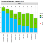
By Meg Muckenhoupt The Mystic River’s most recent water quality report card, released on August 13, gives Winn’s Brook an F for 2019—and the Little River and Alewife Brook earned Ds. The US Environmental Protection Agency (EPA) creates the annual report card in collaboration with the Mystic River Watershed Association. It grades segments of the Mystic River’s lakes, river, and streams on how frequently they meet bacterial standards for swimming and boating. The Upper Mystic Lake and the Chelsea River got an A grade; they met boating and swimming standards 90% or more of the time in 2019. Winn’s Brook [READ MORE]
Arlington Group Opposes Mugar Site Plans
By Meg Muckenhoupt The Mugar wetlands are 17.7 acres of open land in East Arlington. Oaktree Development has proposed constructing a 207-unit apartment complex and six duplex townhouses on this site, to be renamed Thorndike Place. The Coalition to Save the Mugar Wetlands opposes building on the site, which is bordered by Route 2, Thorndike Field, and Dorothy, Edith, and Burch Streets. The following interview with Clarissa Rowe, one of the founders of the Coalition to Save the Mugar Wetlands, was edited for length and clarity. Why is the Mugar site important? I think the reason Arlington and Belmont residents [READ MORE]
Select Board Candidate Answers BCF Questions
Each year, the Belmont Citzens Forum asks Select Board candidates questions about issues facing our town. This year, Adam Dash provided answers. He was limited to 1,200 words. What steps would you take to ensure that the design and construction of the Belmont Community Path proceed efficiently? Finally, after decades of Belmont residents waiting, the community path is being brought to reality. Parts 1A (the Alexander Avenue tunnel under the railroad tracks) and 1B (from Brighton Street to the Clark Street Bridge) are currently being designed. We need to make sure that the construction of Parts 1A and 1B gets [READ MORE]
20 Years of Belmont Water Trouble
By Sumner Brown Belmont has two types of water trouble. One is flooding during heavy rains. The other trouble comes from leaking sewer pipes. Flooding Today, as I write this, there is no flooding in Belmont. Floods are rare enough that we do not make ourselves perpetually anxious about them, but parts of Belmont are vulnerable. In both Belmont and Arlington, people live in what were swamps, and there seem to be 100-year storms every 10 years. Climate change may have something to do with this. The Belmont Citizens Forum advocates for rain gardens and other measures to slow the [READ MORE]
Clay Pit Pond Progresses from Eyesore to Asset
By Michael Chesson Clay Pit Pond on Concord Avenue was once the site of Belmont’s largest industrial enterprise, a brickyard run by John H. and Robert A. Parry. The brothers bought 20¾ acres of land in 1888 on Concord Avenue and Underwood Street, with its valuable blue clay that turned an attractive reddish color when fired, and their yard produced 200,000 bricks a week. Just as the oil, steel, and railroad industries consolidated, the Parry brothers’ business in 1900 merged with the New England Brick Company, which owned three dozen other brickyards in the region. The firm installed new dryers, [READ MORE]