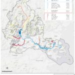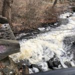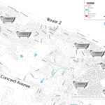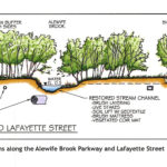
By Kristin Anderson and David White We are at an important point in the history of the Alewife Brook. The Massachusetts Water Resources Authority (MWRA) and the cities of Cambridge and Somerville are preparing a new long-term sewage control plan for the Alewife Brook/Upper Mystic River Watershed. Climate change, with its wetter rainy season, more intense storms, and sea level rise, is expected to result in more hazardous Alewife Brook sewage pollution and more flooding in the area. During some storms, the Alewife Brook floods into the houses, parks, and yards of area residents in environmental justice communities. Because of [READ MORE]
Alewife Brook, Little Pond Get D Grades Again
By Meg Muckenhoupt In 1972, the Clean Water Act called for all waterways to be “fishable and swimmable” by 1983, and for all pollution discharges to end by 1985. That still hasn’t happened, as is shown by the new annual water quality report card issued by the Environmental Protection Agency (EPA) for the Mystic River in July. All of Belmont’s brooks received a D or D+ grade because they failed to meet state E. coli bacteria standards for boating in 45% to 55% of samples taken in 2021. Site 2021 2014 Grade Total Grade Total Alewife Brook D 47% D [READ MORE]
Belmont’s Watersheds Cross Many Boundaries
By Anne-Marie Lambert Here in Belmont, we live on the edge of two large watersheds—the Mystic River watershed and the Charles River watershed. Understanding our role in these watersheds is more important than ever as storms in the Northeast grow more intense and more frequent, and as the rise in Atlantic Ocean sea levels starts to affect the underground water table. The lack of alignment between our political maps and the topography of our watersheds can make it tricky to understand Belmont’s role. In the flat low-lying areas of town where there isn’t much gradient, waters flow in directions that [READ MORE]
Mystic Collaborative Plans For Climate Change
By Julie Wormser Once upon a time, images of climate change featured skinny polar bears on melting ice floes, and hot, dusty desertscapes. Tragic for sure, but also very far away in time and space. Not any more. Last summer’s alarming weather—from 120 temperatures in the Pacific Northwest to record flooding rains here in the Northeast—has brought the immediate effects of climate change into sharper focus and more local concern. In Greater Boston, the most likely risks we need to prepare for are: flooding from intense rainfall and coastal storms/sea level rise, hotter, drier summers, less predictable winter weather, and [READ MORE]
Belmont Waterways Get Failing Grades
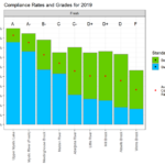
By Meg Muckenhoupt The Mystic River’s most recent water quality report card, released on August 13, gives Winn’s Brook an F for 2019—and the Little River and Alewife Brook earned Ds. The US Environmental Protection Agency (EPA) creates the annual report card in collaboration with the Mystic River Watershed Association. It grades segments of the Mystic River’s lakes, river, and streams on how frequently they meet bacterial standards for swimming and boating. The Upper Mystic Lake and the Chelsea River got an A grade; they met boating and swimming standards 90% or more of the time in 2019. Winn’s Brook [READ MORE]
Clay Pit Pond Progresses from Eyesore to Asset
By Michael Chesson Clay Pit Pond on Concord Avenue was once the site of Belmont’s largest industrial enterprise, a brickyard run by John H. and Robert A. Parry. The brothers bought 20¾ acres of land in 1888 on Concord Avenue and Underwood Street, with its valuable blue clay that turned an attractive reddish color when fired, and their yard produced 200,000 bricks a week. Just as the oil, steel, and railroad industries consolidated, the Parry brothers’ business in 1900 merged with the New England Brick Company, which owned three dozen other brickyards in the region. The firm installed new dryers, [READ MORE]
Belmont’s Underground Pollution Problem
By Anne-Marie Lambert If only the 504 gallons of household wastewater which had been pouring into Wellington Brook and Winn’s Brook through underground culverts every day had been more visible, perhaps we as a town would have addressed the necessary repairs more urgently. That’s what Belmont did when a student noticed an oil spill leaking into Clay Pit Pond during a freeze on December 12, 2003. A ruptured return line to the underground storage tank at Mary Lee Burbank Elementary school travelled through the town’s storm drain system carrying 1,000 gallons of oil to Clay Pit Pond. Alerted to the [READ MORE]
Construction Continues on the Uplands
By Anne-Marie Lambert The first red-winged blackbirds now returning to the fields by Little River may not think much of the “wildlife habitat replication area” alongside the newly constructed buildings at the Uplands. This newly seeded replication area sits between the former Little River, now a large drainage ditch next to Frontage Road, and one of the four-story Tyvek-wrapped buildings that comprise The Royal, formerly named The Residences at Acorn Park. In a contested 2014 ruling, the Massachusetts Superior Court determined that this replication area (next to what amounts to a Route 2 drainage ditch running under Acorn Park Drive) [READ MORE]
Heustis Farm Grew on Uplands Site
By Anne-Marie Lambert This article is the second in a series of articles about the history of the Belmont Uplands. For Part 1, see “Uplands Area Transformed Over Centuries” in the September/October 2014 Belmont Citizens Forum Newsletter. We don’t know how exactly how Warren Heustis of Putney, Vermont met Lucy Ann Hill of West Cambridge (now Belmont). We do know they married in 1845, and that Warren brought farming skills to Belmont that would turn “useless swamp land” into one of the best performing farms in Belmont, the Heustis Farm. This is their story. Today it is hard to imagine [READ MORE]