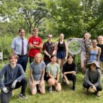
by Jean Devine An open mind, eagerness to learn new things, a willingness to work with peers from different schools, and a tolerance for hot weather, a bit of rain, and getting dirty are all it takes to be a Biodiversity Builder. Youth don’t join Biodiversity Builders (BB) to fill out their resume. They join because they’re curious about nature and maybe gardening, they worry about climate change, and they want to do something positive to help the planet. Youth who become Biodiversity Builders learn how to solve environmental and societal challenges, get down and dirty removing invasive plants and [READ MORE]
Beavers vs Us: Who Manages Stormwater Best?
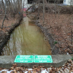
By Anne-Marie Lambert There’s a lot of complexity but not much bureaucracy involved when beavers take action to manage stormwater. Beavers don’t follow many rules and regulations to slow down a brook’s flow to a prescribed amount or filter pollutants like phosphates or nitrates. They don’t submit maintenance plans for what they will do differently when large rainstorms or new pollutants arrive. Beavers don’t wait for permit approvals or make decisions based on a checklist of laws and regulations. Beavers have evolved to build their homes across brooks to create whole new ecosystems that support many species that have evolved [READ MORE]
EPA Pushes for Alewife Sewage Cleanup
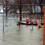
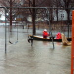
By Kristin Anderson and David White We are at an important point in the history of the Alewife Brook. The Massachusetts Water Resources Authority (MWRA) and the cities of Cambridge and Somerville are preparing a new long-term sewage control plan for the Alewife Brook/Upper Mystic River Watershed. Climate change, with its wetter rainy season, more intense storms, and sea level rise, is expected to result in more hazardous Alewife Brook sewage pollution and more flooding in the area. During some storms, the Alewife Brook floods into the houses, parks, and yards of area residents in environmental justice communities. Because of [READ MORE]
Alewife Brook, Little Pond Get D Grades Again
By Meg Muckenhoupt In 1972, the Clean Water Act called for all waterways to be “fishable and swimmable” by 1983, and for all pollution discharges to end by 1985. That still hasn’t happened, as is shown by the new annual water quality report card issued by the Environmental Protection Agency (EPA) for the Mystic River in July. All of Belmont’s brooks received a D or D+ grade because they failed to meet state E. coli bacteria standards for boating in 45% to 55% of samples taken in 2021. Site 2021 2014 Grade Total Grade Total Alewife Brook D 47% D [READ MORE]
What is a CISMA, and Why Do We Need One?
By Jeffrey North New York state has eight very large ones. Oregon has 10. Michigan has more than 20 (required by law for every county). The number of Comprehensive Invasive Species Management Associations (CISMAs) across the country is approaching 400. Massachusetts has one. But that number is likely to increase. With the likely passage of the invasive species bill (H4595), financial and administrative resources will be available for CISMAs and a host of other programs, plans, and projects for controlling invasive plants. The bill would establish an invasive species trust fund. A statewide invasive species coordinator would be appointed, along [READ MORE]
Belmont’s Watersheds Cross Many Boundaries
By Anne-Marie Lambert Here in Belmont, we live on the edge of two large watersheds—the Mystic River watershed and the Charles River watershed. Understanding our role in these watersheds is more important than ever as storms in the Northeast grow more intense and more frequent, and as the rise in Atlantic Ocean sea levels starts to affect the underground water table. The lack of alignment between our political maps and the topography of our watersheds can make it tricky to understand Belmont’s role. In the flat low-lying areas of town where there isn’t much gradient, waters flow in directions that [READ MORE]
Mystic Collaborative Plans For Climate Change
By Julie Wormser Once upon a time, images of climate change featured skinny polar bears on melting ice floes, and hot, dusty desertscapes. Tragic for sure, but also very far away in time and space. Not any more. Last summer’s alarming weather—from 120 temperatures in the Pacific Northwest to record flooding rains here in the Northeast—has brought the immediate effects of climate change into sharper focus and more local concern. In Greater Boston, the most likely risks we need to prepare for are: flooding from intense rainfall and coastal storms/sea level rise, hotter, drier summers, less predictable winter weather, and [READ MORE]
What is the Future of the Royal Road Woods?
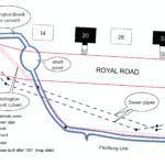
By Vincent Stanton, Jr. Skip to Bonus Material In 1844, when the Fitchburg Line was built, the Clark family owned a triangular lot bounded by the new train line, Common Street, and Clark Street. Wellington Brook ran along the north side of the triangle, just south of the Fitchburg Line. Royal Road and Dunbarton Street did not exist. After more than a century of Clark descendents the land was sold in 1931 to the Glendower Trust, a vehicle of real estate developers John Hubbard and Donald Kenyon. Hubbard and Kenyon laid out plans for Dunbarton Street and Glendower Road (shortly [READ MORE]
Watershed Modeling Enhances Flood Resilience
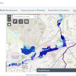
By Julia Hopkins and Julie Wood Climate change isn’t coming—it’s here. Sea-level rise, drought, blistering heat; the tangible effects of global warming are already happening in Massachusetts, and our highly urbanized watershed and those who call it home are increasingly vulnerable to its impacts. It also means extreme weather and severe inland flooding are some of the greatest threats to our watershed and our lives. In the northeastern United States, precipitation during heavy rain events increased by more than 70% according to the Fourth National Climate Assessment released in 2018. This trend is expected to continue as our climate warms. Today’s [READ MORE]
Fifty Million Gallons of Sewage Released
Discharges to Alewife Brook Have Persisted for Two Decades By Kristin Anderson and David White Fifty million gallons of sewage-contaminated stormwater have been discharged into the Alewife Brook from the cities of Cambridge and Somerville in 2021, according to websites for those two cities and the Metropolitan Water Resources Authority (MWRA) for the Alewife/Upper Mystic Combined Sewer Overflow (CSO). There has been as much sewage-contaminated water discharged into the Alewife Brook in 2021 as there was in 1997 before the implementation of a $200 million plan to modernize the area’s antique combined sewer systems. Pollution persists in the Alewife sub-watershed [READ MORE]
CRWA Works to Keep the Charles River Clean
By Julia Hopkins and Lisa Kumpf Have you ever thought about what happens to that rain when extreme storms hit? If you call Belmont home, it ends up in the Charles or the Mystic River. The town of Belmont is sandwiched between the Charles and Mystic Rivers, two beautiful, fragile natural resources that provide habitat for wildlife and enjoyment for humans. The town is split between the Charles River watershed and the Mystic River watershed. A watershed is a land area that channels all rain and snowmelt into ponds, brooks, and streams that drain into a single river, and eventually [READ MORE]
Belmont Has One Year to Clean up Waterways
By Anne-Marie Lambert A 2017 consent order from the US Environmental Protection Agency (EPA) gave Belmont five years to stop underground sewage from leaking into our waterways. We made a lot of progress in 2020, but there could be a long way to go before all our outlets run clean. In 2020, the town undertook a $550,000 sewer system rehabilitation construction project (SSRCP). More work is planned in 2021 under a sump pump removal and sewer rehabilitation contract. The SSRCP included significant work such as: Repairing and lining several sewer mains Lining many sewer service laterals Removing a few sewer [READ MORE]
Clay Pit Pond Deforestation Damages Wetland
By Judy Singler In September 2020, several Belmont residents removed more than 80 trees and shrubs from the south side of Clay Pit Pond. In an unauthorized action taken ostensibly to “enhance” the view of the pond, individuals visited the site on at least three occasions that month, cutting down 50-foot-tall trees, shrubs, vines, and other vegetation. The remaining trees at the edge of the pond were pruned of side branches to a height of 20 feet and more. Town officials eventually ordered a halt to the illegal tree cutting after calls from several concerned citizens. Environmental Laws Exist to [READ MORE]
Jerry’s Pond May Have A Chance to Shine
By Greg Harris Since developers have targeted the Alewife area for rapid development, with housing interests erecting massive apartment complexes and life sciences companies rushing to turn the area into a second Kendall Square, long-time residents have feared the trampling of their history, quality of life, community health, and the remaining natural environment. But these changes present opportunities as well as risks. If a coalition of long-time residents and neighborhood activists get their way, life science developer IQHQ’s $125 million dollar acquisition of land next to the Alewife T Station may result in the resurrection of Jerry’s Pond. This neighborhood [READ MORE]
Belmont Waterways Get Failing Grades
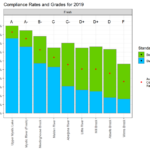
By Meg Muckenhoupt The Mystic River’s most recent water quality report card, released on August 13, gives Winn’s Brook an F for 2019—and the Little River and Alewife Brook earned Ds. The US Environmental Protection Agency (EPA) creates the annual report card in collaboration with the Mystic River Watershed Association. It grades segments of the Mystic River’s lakes, river, and streams on how frequently they meet bacterial standards for swimming and boating. The Upper Mystic Lake and the Chelsea River got an A grade; they met boating and swimming standards 90% or more of the time in 2019. Winn’s Brook [READ MORE]
Arlington Group Opposes Mugar Site Plans
By Meg Muckenhoupt The Mugar wetlands are 17.7 acres of open land in East Arlington. Oaktree Development has proposed constructing a 207-unit apartment complex and six duplex townhouses on this site, to be renamed Thorndike Place. The Coalition to Save the Mugar Wetlands opposes building on the site, which is bordered by Route 2, Thorndike Field, and Dorothy, Edith, and Burch Streets. The following interview with Clarissa Rowe, one of the founders of the Coalition to Save the Mugar Wetlands, was edited for length and clarity. Why is the Mugar site important? I think the reason Arlington and Belmont residents [READ MORE]
Fernald Site Update
by George A. Darcy III On October 26, 2015, the Waltham City Council approved a $1.2 million appropriation for the demolition of 20 non-historic buildings in the northwest quadrant of the 196-acre recently acquired Fernald property. Waltham Mayor Jeannette McCarthy submitted the CPA application for demolition to the Community Preservation Committee. The buildings that will come down include four Malone Park structures, 11 cottages, Site 5, Site 7, Activity Center, Woodside, and Brookside. The cottages were constructed as a result of Judge Joseph Tauro’s decree for the state to build residential-like structures for the residents of Fernald. Unfortunately, these homes [READ MORE]
Cambridge Redirects Runoff from 400 Acres
Cambridge Sewer Separation Makes Alewife Brook Cleaner By Anne-Marie Lambert On December 21, 2015, Cambridge celebrated a major milestone of the Alewife Sewer Separation project, a massive public works that separates sanitary sewers from storm sewers. When these two types of sewers are connected, heavy storms drive raw sewage into local waterways such as the Alewife Brook—as has been happening at the Brook for decades. As of December 21, the city will now provide water quality treatment of stormwater runoff from more than 400 acres of the urbanized Huron Avenue and Fresh Pond neighborhoods by directing it to the 3.4-acre [READ MORE]
Mugar Site Plans May Mean More Flooding
Along the north side of Route 2 in East Arlington lie seventeen acres of wetlands almost entirely in the 100-year floodplain. Despite its potential for flooding, this parcel has been the subject of various development proposals over the years. Recently Oaktree Development of Cambridge showed Arlington town officials a preliminary sketch of a proposed 219-unit housing development on the parcel owned by the Mugar family and adjacent to the Alewife Reservation. The Oaktree developer intends to invoke the state Chapter 40B statute to circumvent certain local permitting processes and bylaws by including a certain percentage of affordable housing in the [READ MORE]